Citiraj:
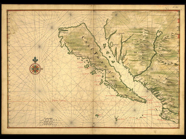
Cartographic errors can persist for centuries, surviving even evidence to the contrary. One of the most famous examples is the curious case of California as an island. In 1533, the Spanish conquistador Hernando Cortes sent an expedition to the westernmost portion of the United States. His men landed on the southern tip of what is now Baja and promptly named this newly discovered territory the island of California—a direct reference to Las Sergas de Esplandian, a Spanish chivalric novel from 1510, describing "on the right hand of the Indies […] an island called California very close to the side of the Terrestrial Paradise; and it is peopled by black women, without any man among them, for they live in the manner of Amazons."
Baja, of course, is neither an Amazonian paradise nor an island. It's a peninsula—a fact that became obvious to the Spanish as early as 1539. But on contemporary maps, the erotic and exciting Las Sergas de Esplandian won out over boring topographic reality. Even as the true, "continental" version of California became the standard, the insular version surfaced occasionally well into the 18th century—like a bad habit, or maybe more accurately, a long-held wish for a more mystical, Las Sergas-like new world that mapmakers couldn't quite let go.
http://www.slate.com/id/2236256/?GT1=38001Konkvistadori ipak nisu daleko od istine, jednog dana to će postati ostrvo.